I first met you in the Gis open chat room and even made a purchase. Thank you. ㅎㅎ
5.0
fkdlfkdl68
70% enrolled
This lecture was like a ray of light when I was feeling lost while working on a project at school. ㅠㅠ
5.0
논문학살자
38% enrolled
I was learning GIS for school recently, and this QGIS lecture was exactly what I needed.
The lecture structure is concise, and the content explained by the instructor and the supplementary materials are excellent, so it goes right into my ears.
It was hard to find GIS lectures, but I'm glad I found such a great lecture. If there's anyone who's hesitating to take the class, definitely listen to it!!!!
What you will gain after the course
Basic GIS vector data analysis functions
Basic Python Knowledge for QGIS Automation
Automating analysis tasks using Python and QGIS
🌟QGIS Python Automation (Vector Edition) Version.2 Renewed Version🌟 is back Please check the renewal introduction section below for details!!
A convenient world met through coding! 🌎 With this QGIS Python automation course, master Python, GIS, and automation all at once.
Starting Python QGIS Automation with a Single Course 📖 #QGIS #GIS #data-analysis #spatial-data #python #python-automation #GIS-Lecture #GIS-Education
😥
GIS, which has recently seen a rapid increase in utility and importance. Does it still feel unfamiliar and difficult to you?
😒
Python, used by everyone from students to professionals. Are you tired of learning nothing but boring theories?
🤔
Automation saves my time and money. Do you want to apply it to GIS as well?
👉 If so, take this course!
The most essential QGIS functions, Python code, and QGIS automation analysis methods using both are all included. Meet QGIS Python Automation (Vector Edition) Ver.2, where you can learn quickly from the basics!!
Why should you take this QGIS Python Automation course? 😲
The space we live in is becoming increasingly subdivided and sophisticated. This leads to the diversification of spatial data, which has now become so close to our lives that we can no longer afford to ignore it.
This lecture provides a friendly introduction to the concepts and practical analysis functions of GIS, which form the foundation of spatial data.
By the way, what is GIS?
GIS (Geographic Information System) refers to a 'Geographic Information System' that converts geographic information necessary for our lives into computer data to be utilized efficiently.
Data collectionstorageprocessing analysisvisualization
Coding has also become an essential element of our lives. For modern people who cannot live a life separated from digital technology, coding is an important tool that will make our lives more convenient and prosperous. The basic syntax of Python learned in this course is directly linked to the final goal of the course, the automation of QGIS.
So that you can string information together effectively! 💡
There is a saying that "even if you have three bushels of beads, they are not a treasure unless they are strung together." We are living in an era overflowing with beads of information, but we find ourselves constantly chased by time because we cannot actually string them together.
This course shares how to automate using GIS and Python to string the beads together quickly and efficiently.
After taking this course! 🎓
⌚
You can save your precious time.
You can automate GIS tasks that were previously handled manually by delegating them to a computer with just a few lines of code.
🚀
Failure is no longer something to fear.
Did something come up that needs to be fixed in the middle? By simply changing the numbers, you can re-run the analysis as many times as you want with just one click.
🤩
You can turn everything you imagine into reality.
It's not that you won't be able to use other features just because we practice specific ones. This course teaches you how to fish.
Learn the following content ✅
You can learn both GIS and Python.
Theory and practice are covered all at once.
We enhance understanding with friendly explanations.
You can take this course even if you don't know anything.
By learning automation methods, you can write code for anything you want.
So, we recommend it to these people! 👍
GIS Beginners - Learn the basic concepts and fundamental analysis functions of GIS through the open-source program QGIS.
Python Beginners - Put aside difficult theories and get familiar with coding by solving practical problems together.
GIS professionals and researchers - You will be able to automate many processes that were previously handled manually by using Python code within QGIS.
Check out the curriculum 📚nhé 📚
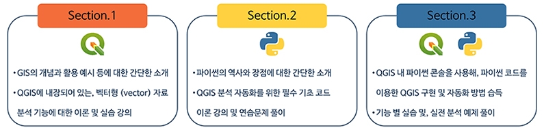
Section 1. GIS Concepts > QGIS Basic Theory Learning > Practice
Section 2. Learning basic Python functions > Solving practice problems
Section 3. Learning QGIS Automation Methods > Practice
Section 4. Solving 4 types of practical examples to check your honed skills
The course is designed with a concise and clean structure. Drawing from my experience as a current researcher, you will practice essential QGIS basic functions that are most frequently used. Before taking the full course, try it out through the free lessons!! nhé!!
As a non-coding major myself, I understand the difficulties of encountering coding for the first time better than anyone. Instead of boring theory, you can learn while experiencing the fun of coding through practical exercise problem-solving.
We will practice automating QGIS functions using Python with code that can be applied in real-world scenarios. After completing the practice, we have organized three analysis processes into practical analysis examples.
- Practical Example 1: Analysis of Public Wi-Fi Underserved Areas in Seoul - Practical Example 2: Analysis of Buildings Jointly Included Within the Radius of Seoul Bus Stops and Subway Stations - Practical Example 3: Creation of Land Cover Maps by District in Seoul - Practical Example 4: Analysis of the Number of Serviceable Emergency Rooms According to Buffer Zones by Legal Dong in Seoul
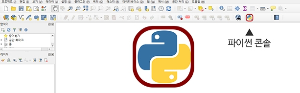
Python hidden in QGIS? Did you know? 🔍
QGIS is an open-source GIS that can utilize various plugins, allowing you to perform powerful functions required for GIS through Python code.
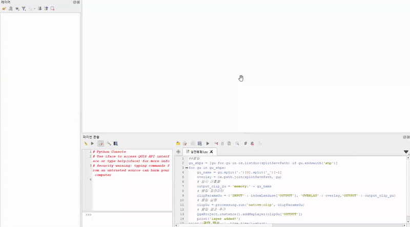
QGIS has a built-in Python console. We can use this Python console to execute all available analysis functions in QGIS.
Coding is a set of instructions delivered to a computer. You can automate the process for the computer with a few lines of typing, replacing the analysis steps you used to click through one by one by hand.
However, these methods are not well-introduced in Korea. Knowing the functions is useless if you cannot use them. This course teaches you the "method" of commanding QGIS to perform the analysis you want through the Python language.
The GIF below is the result of the example code used in the actual class. Through the -Practical Example 3- lecture, try automating all the GIS analysis you've ever imagined!! A Python code guidepersonally written by the instructor for convenient automation is also provided!!tự động hóa một cách tiện lợi!!
All course materials and practice files used in the lecture have been compressed and uploaded. Please download the materials once at your convenience and enjoy the lecture!!
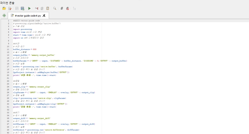
QGIS code guide provided for convenient coding!! 🧩
The instructor has personally written and provided a Python code guide for all QGIS functions used in Section 1 and Section 3. Utilize the code guide to easily modify parameters according to QGIS functions and use them to your heart's content!! And try modifying them into your own code to suit your taste!!
Since the initial release of the lecture, new features (Join Attributes by Location Summary, Join Attributes Table) have been updated with additional theory & hands-on practice and Python code exercises.
Additionally, I have added Practical Example 4 so that you can apply both newly learned and existing functions in more complex environments.
Additionally, I have re-recorded and uploaded the sections on Buffer, Clip/Intersect, and Dissolve/Delete Holes from the existing course content, so current students are encouraged to check them out. The lecture materials have also been newly organized and uploaded according to the section numbers and lesson content, so please check those as well. Thank you! :)
Q&A 💬
Q. Is basic knowledge required?
Having prior knowledge of GIS and Python will be a great help in understanding the lecture and making the content your own. However, even if you have never used them before, there is no need to worry as I will explain everything starting from the basics. 😊
Q. In which fields can this be used?
I am a doctoral student and primarily use it for my research. I believe it will be highly useful for fellow students like myself or those who use GIS for their work. However, the world is full of endless tasks and possibilities. I expect it to be utilized effectively in any field where GIS can be applied.
Q. Can I skip the parts I already know?
Yes, this lecture covers the basics of GIS and Python. If you are specifically interested in automation methods, you may skip directly to Section 3. However, please check the table of contents for Section 1 and Section 2 first, and if there is anything you are unfamiliar with, I recommend taking those lessons before moving forward! 👍
Q. Will I actually use this a lot after finishing the course?
Before I started using Python within QGIS for analysis, I performed all tasks manually. However, in order to improve work efficiency, I began studying analysis through coding, and now I handle most tasks—even simple analyses—using code. If you take this course and build up your own code through actual application, you will be able to equip yourself with convenient tools that you can use frequently. 💻
Q. What are the advantages of integrating QGIS and Python?
You can simultaneously utilize the advantages of Python coding and the features offered by QGIS software!! 🎉
Various Python modules such as geopandas and folium already support GIS tasks within Python. However, the limitations of working solely with Python modules are clear. Immediate and diverse visualization is difficult, and integration with local files is complex. Furthermore, there are limitations regarding analysis functions.
However, Python code executed within QGIS can be added directly to QGIS layers, allowing you to utilize all available QGIS features in the same way thereafter.
I would also like to introduce other QGIS courses by the instructor 🔗
(Click the image to go to the course page)
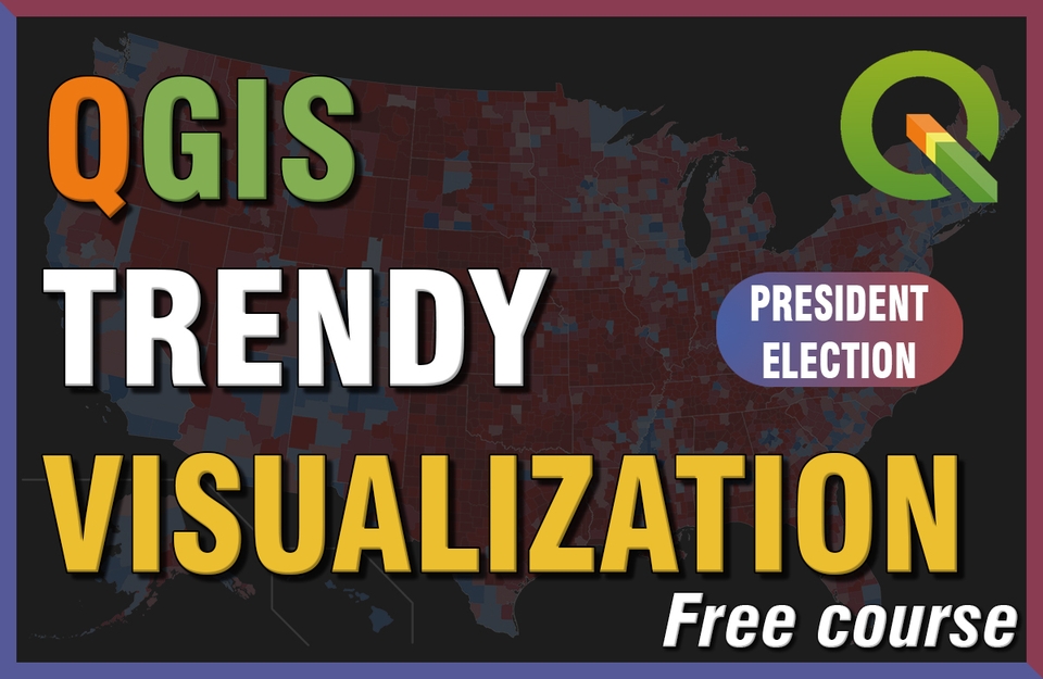
A Quick Taste of Trendy QGIS Visualization
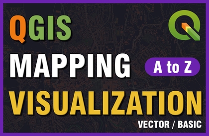
QGIS Map Visualization A to Z (Vector/Basic Edition)
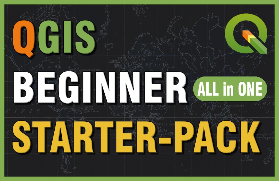
QGIS All-in-One Starter Pack for Beginners
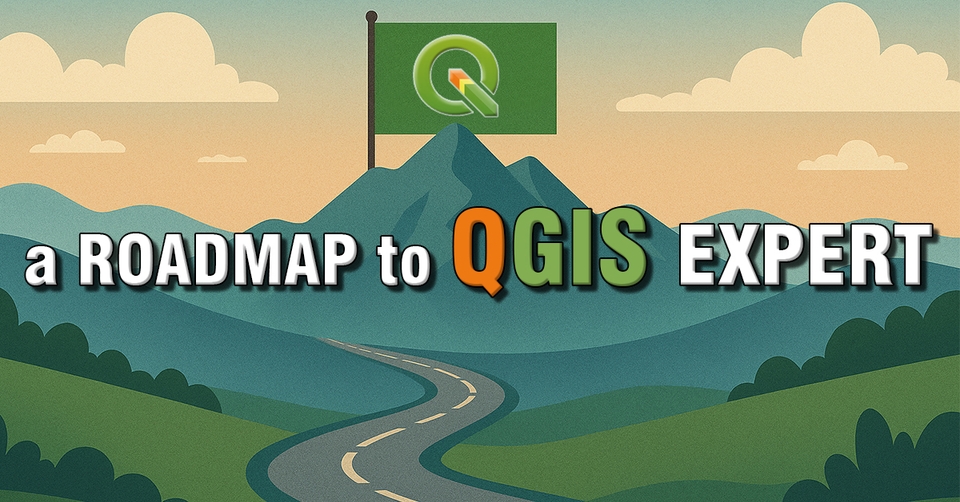
Check out the roadmap categorized by topic and difficulty level!!
-Data Visualization that Transforms Reports- Data Utilization Competency Enhancement Training (2nd Session); Hosted by Gyeonggi-do Provincial Human Resources Development Institute; 2022.12.07. & 09.
Capacity Building Training for Water Industry Employees - Digital Program Practice (Beginner) & Q-GIS Practice (Intermediate); Hosted by K-water; 2023.06.19.-20.
QGIS Basic Special Lecture; Hosted by the Instructor; 2023.10.07-08.
WISE-UP WORKSHOP Urban Spatial Data Analysis; Hosted by SNU Graduate School of Environmental Studies-BK21 Smart City Research Group; 2024.02.23.
Creating Our School Map Using Public Data (Dongbuk High School); Organized by Seoul National University Center for Continuing Education; 2024.05.11.
Creating Our School Map Using Public Data (Samsung High School, Seomun Girls' High School); Hosted by Seoul National University Institute for Continuing Education; 2024.07.08. - 10.
"2024 Water Company Employee Competency Enhancement" Training - Digital Program Practice (Basic) - Q-GIS Practice; K-water; 2024.10.02.
2024 Comprehensive Evaluation Plan for Regulated Pests - Visualization of Fire Blight Outbreaks Using QGIS; Chungnam Agricultural Research and Extension Services; 2024.10.16.
Data Analysis Expert Training Course; Korea Environment Corporation; 2024.10.25.
Data Analysis Expert Training Course; Korea Environment Corporation; 2025.04.23.
Big Data Analyst Training Course Using AI; SeSAC; 2025.07.08-16.
Understanding GIS and Spatial Analysis via DBMS & Data Visualization (Basic); Hyundai NGV; 2025.10.23-24.
Understanding GIS and Spatial Analysis & Data Visualization via DBMS (Advanced); Hyundai NGV; 2025.11.10-12.
I was learning GIS for school recently, and this QGIS lecture was exactly what I needed.
The lecture structure is concise, and the content explained by the instructor and the supplementary materials are excellent, so it goes right into my ears.
It was hard to find GIS lectures, but I'm glad I found such a great lecture. If there's anyone who's hesitating to take the class, definitely listen to it!!!!
Hello. This is UPWISE.
I'm curious about what areas you use GIS in at school :)
I also used GIS a lot for research and projects, and I started automating Python for work efficiency, so I'm happy.
Thank you for leaving a great review, and I hope my lecture was of some help.
Thank you. 😀
UPWISE Dream
This is the best lecture recommended to both beginners and practitioners of GIS!!!
Since the lecture was uploaded, I have listened to all the lectures during the holiday period.
Currently, I am only solving 3 real-life examples and comparing them with the solution videos uploaded by the instructor.
I think the biggest advantage of this lecture is its clear goals and maximizing learning efficiency through practice.
As you mentioned in the lecture introduction video, the ultimate goal is to learn automation methods using QGIS and Python, and I felt that all the lectures in each section are aimed at that goal.
I use GIS frequently in my field, and I often use simple functions rather than advanced analysis functions. Fixed repetitive tasks were the main focus, but I am going to apply what I learned this time to my work right away!! :)
It was hard to find GIS lectures on Infraon as well as other lecture platforms, so I would like to thank the instructor for creating such a wonderful lecture, and I look forward to other contents you will create in the future!!
Hello. This is UPWISE.
Thank you for taking all the lectures even though it hasn't been long since I uploaded them.
You said that you mainly use GIS for work, so I hope my lectures will be helpful for your related work.
Thank you for the great review of the lectures, and I will see you again when the lectures are produced in the future.
Thank you. 😀
UPWISE Dream
Hello. This is UPWISE.
This is my first time making a lecture, so I think there are many shortcomings, but thank you for your kind words.
I will come back later with a GIS lecture on a different topic. Thank you. 😀
UPWISE Dream


![[Free] A Taste of Trendy QGIS Visualization (Presidential Election Map)Course Thumbnail](https://cdn.inflearn.com/public/files/courses/337567/cover/01jwebxr77n1rygt6nq9azcn4b?w=420)


![[Renewed] Python Machine Learning Bootcamp for Beginners (Easy! Learn by Solving Real Kaggle Problems) [Data Analysis/Science Part2]Course Thumbnail](https://cdn.inflearn.com/public/courses/327464/cover/55c4db7b-7764-43cc-ac75-d9e8d08098f1/327464-eng.png?w=420)