Big Data Analyst Exam Practice (Python)
dee
Free
Basic / Big Data, Python
4.9
(119)
5,100+
This is a lecture on the National Technical Qualification Big Data Analysis Technician Practical with Python. We hope you all pass!
Basic
Big Data, Python
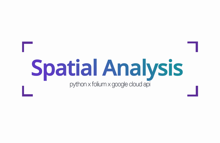
Challenge yourself with versatile Python
Map-based spatial analysis + visualization! 🧭
![]()
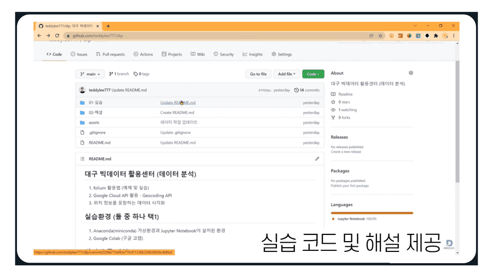
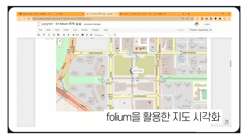
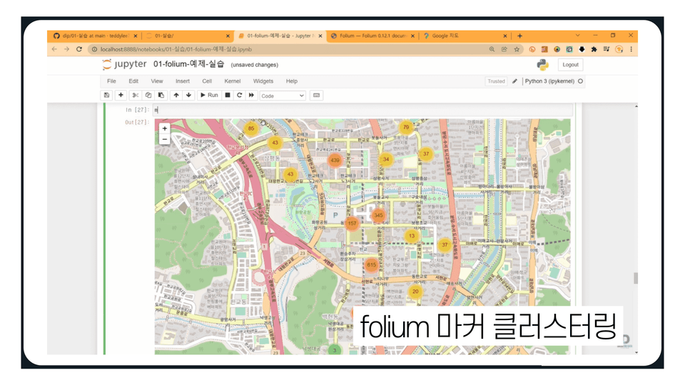
Using only Python-based Polyum library + Google API
You can do spatial analysis on maps !
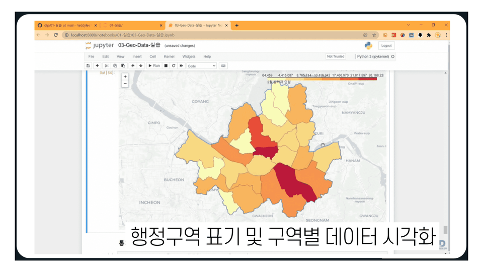
Among various data analysis processes, spatial analysis is performed to analyze location and geographic data.
Based on the programming language Python, you will learn how to visualize data and draw analytical conclusions using Folium, Google Cloud APIs, and other tools.
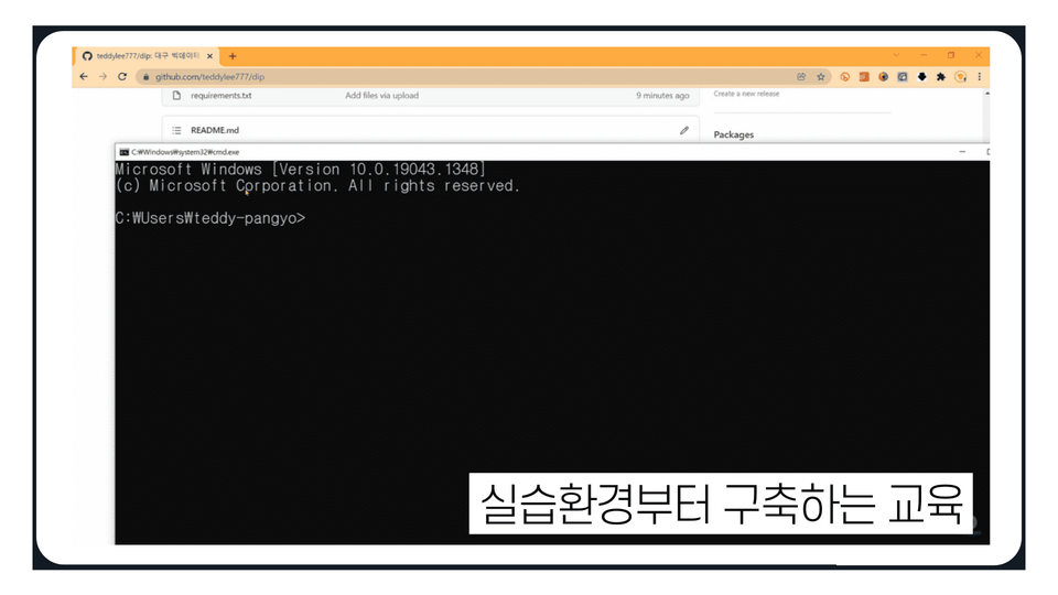
Even beginners new to spatial data analysis can benefit. Instead of relying on complex visualization tools or GIS-specific analysis tools, try out a familiar Python library for a fun way to analyze spatial data!

Learn the basics of using Folium for spatial data analysis.
You can use various data-related functions provided by Folium.
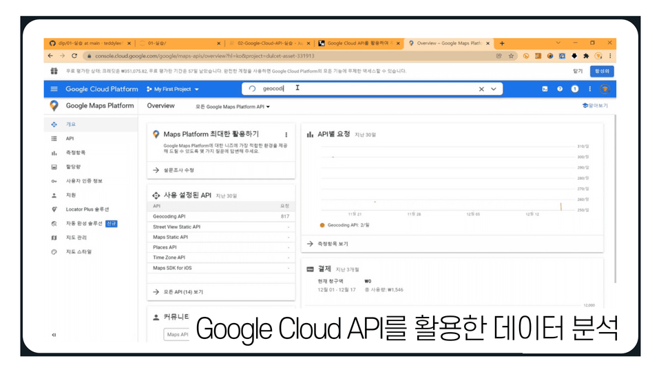
You can preprocess/convert and utilize Geo Data using the Geocoding API.
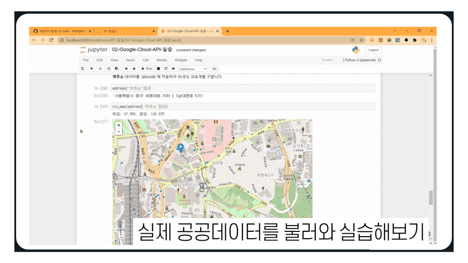
You can perform map visualization and spatial analysis using real public data.
I was looking for map visualization methods and this is really helpful! I'm going to try applying it to my personal project too! Thank you.
Kinder and cleaner lecture than Kaggle geospatial.
Thank you for the great lecture!
I received a lot of help.
I learned a lot about development using Python modules. Thank you for the great lecture~^^
![[For Beginners] Data Visualization with Power BICourse Thumbnail](https://cdn.inflearn.com/public/courses/327055/cover/455b54c1-3e63-439b-9b60-5d12e12bc303/PowerBI-001 (1).png?w=420)
![[For Beginners] Machine Learning Analysis with AutoKerasCourse Thumbnail](https://cdn.inflearn.com/public/courses/327164/cover/2825a3d8-08a1-4baf-9a21-698f89e877e3/인프런 강의 이미지.png?w=420)
![[For Beginners] Data Visualization with QGISCourse Thumbnail](https://cdn.inflearn.com/public/courses/327036/cover/22665c92-3392-4ea7-9bc5-b49a779b663d/QGIS_복사본-001.png?w=420)
![[Mito] Python Data Analysis Starting with MitoCourse Thumbnail](https://cdn.inflearn.com/public/courses/327600/cover/86eb8935-b4ba-4c9b-a13d-c52b423219bd/327600-eng.png?w=420)
![[For Beginners] Machine Learning with Kaggle • Deep Learning AnalysisCourse Thumbnail](https://cdn.inflearn.com/public/courses/327034/cover/303d9d8a-4e3e-4654-b9fd-4000b7628324/캐글 _복사본-001.png?w=420)