Big Data Analyst Exam Practice (Python)
dee
Free
Basic / Big Data, Python
4.9
(115)
5,000+
This is a lecture on the National Technical Qualification Big Data Analysis Technician Practical with Python. We hope you all pass!
Basic
Big Data, Python
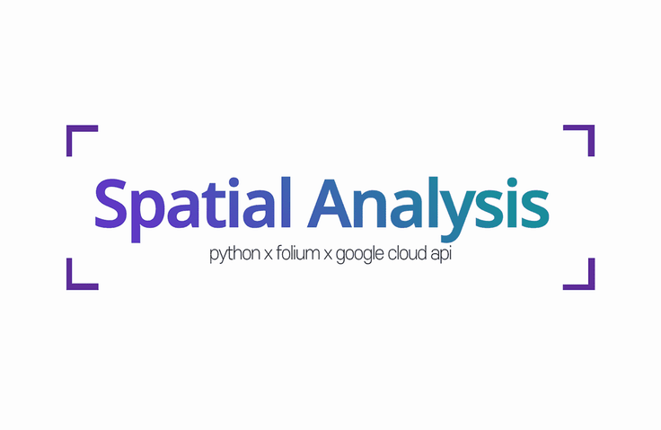
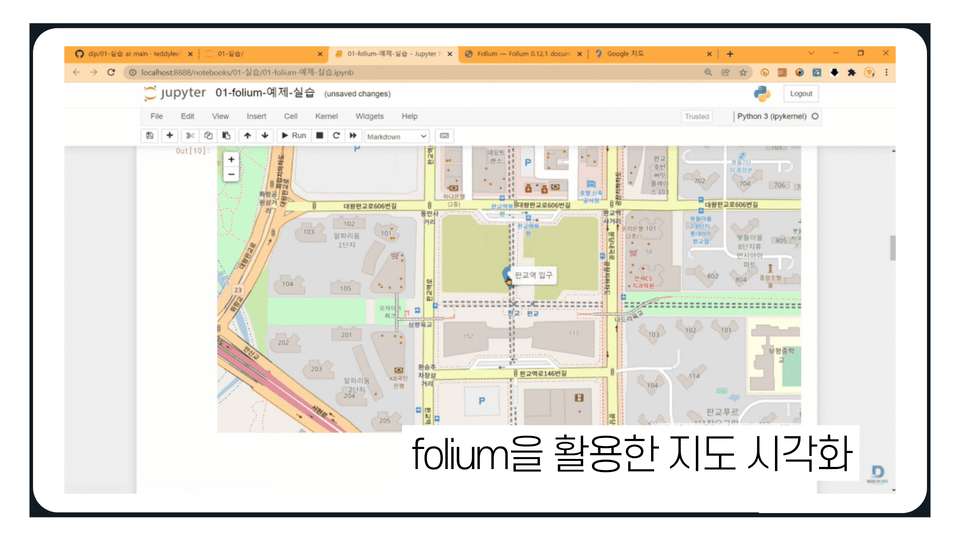
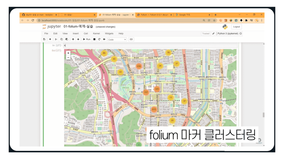
Let's use the Folium library and Google Cloud API provided by default in Python. You can perform spatial data analysis based on coding without a separate tool.
Reviews from Early Learners
5.0
Jang Jaehoon
Thank you for the great lecture!
5.0
Stella Kim
I was looking for map visualization methods and this is really helpful! I'm going to try applying it to my personal project too! Thank you.
5.0
고명진
Kinder and cleaner lecture than Kaggle geospatial.
Folium
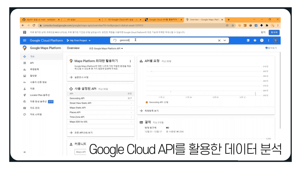
How to use Google Cloud API
Spatial Analysis Fundamentals
Challenge yourself with versatile Python
Map-based spatial analysis + visualization! 🧭
![]()
Using only Python-based Polyum library + Google API
You can do spatial analysis on maps !
Among various data analysis processes, spatial analysis is performed to analyze location and geographic data.
Based on the programming language Python, you will learn how to visualize data and draw analytical conclusions using Folium, Google Cloud APIs, and other tools.
Even beginners new to spatial data analysis can benefit. Instead of relying on complex visualization tools or GIS-specific analysis tools, try out a familiar Python library for a fun way to analyze spatial data!

Learn the basics of using Folium for spatial data analysis.
You can use various data-related functions provided by Folium.
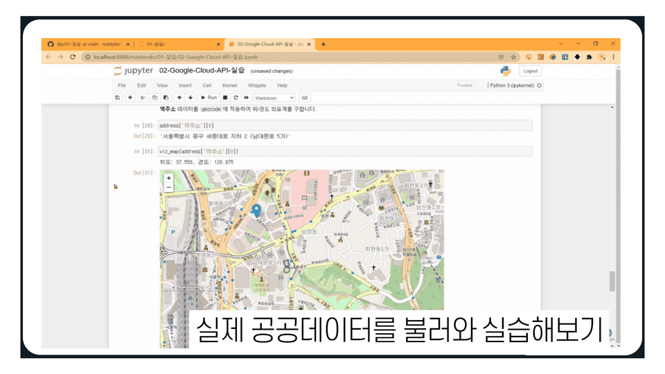
You can preprocess/convert and utilize Geo Data using the Geocoding API.
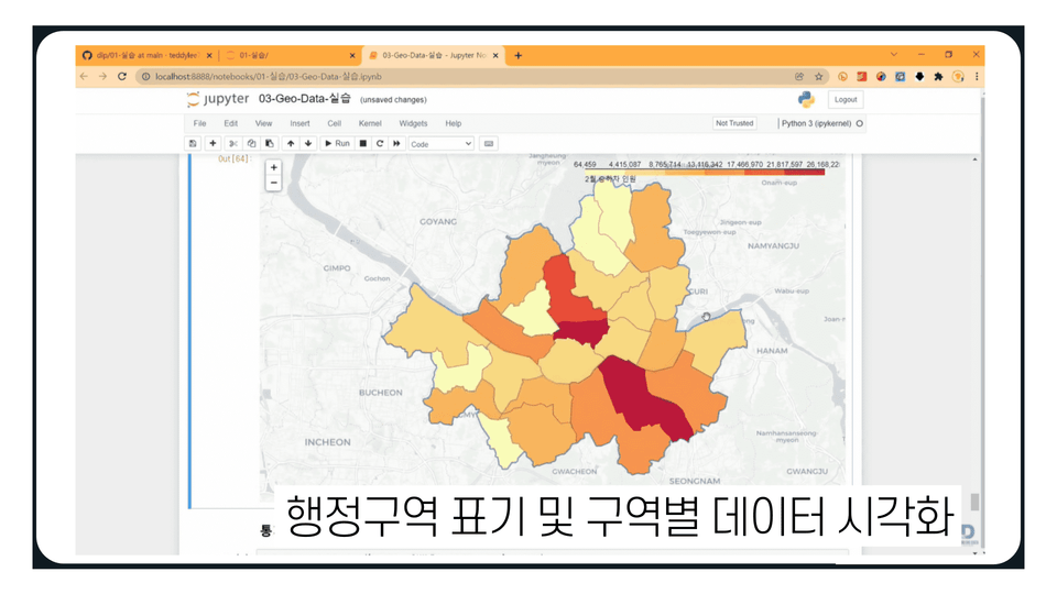
You can perform map visualization and spatial analysis using real public data.
Who is this course right for?
People who want to do data analysis using Python modules
Anyone who wants to try map-based spatial analysis and visualization
Need to know before starting?
Python
14,691
Learners
382
Reviews
17
Answers
4.7
Rating
7
Courses
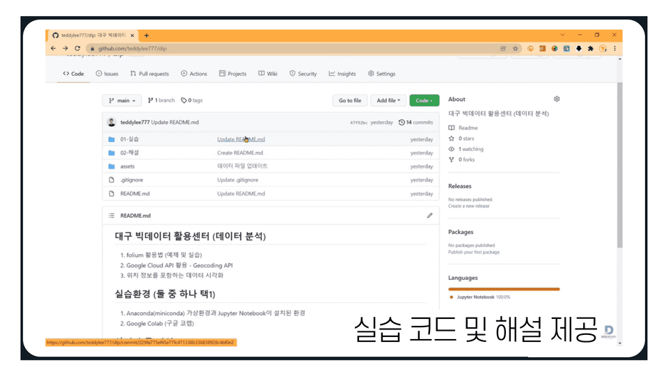
This is the DIP Daegu Big Data Utilization Center.
Our staff, consisting of data analysts, are conducting the lectures. :)
If you visit the center, we provide data analysis and consulting support free of charge.
Homepage YouTube Channel
All
19 lectures ∙ (2hr 29min)
All
24 reviews
5.0
24 reviews
Reviews 18
∙
Average Rating 4.4
Reviews 3
∙
Average Rating 5.0
Reviews 1
∙
Average Rating 5.0
Reviews 731
∙
Average Rating 4.9
Reviews 3
∙
Average Rating 5.0
Check out other courses by the instructor!
Explore other courses in the same field!
Free
![[Mito] Python Data Analysis Starting with MitoCourse Thumbnail](https://cdn.inflearn.com/public/courses/327600/cover/86eb8935-b4ba-4c9b-a13d-c52b423219bd/327600-eng.png?w=420)
![[For Beginners] Machine Learning Analysis with AutoKerasCourse Thumbnail](https://cdn.inflearn.com/public/courses/327164/cover/2825a3d8-08a1-4baf-9a21-698f89e877e3/인프런 강의 이미지.png?w=420)
![[For Beginners] Data Visualization with Power BICourse Thumbnail](https://cdn.inflearn.com/public/courses/327055/cover/455b54c1-3e63-439b-9b60-5d12e12bc303/PowerBI-001 (1).png?w=420)
![[For Beginners] Data Visualization with QGISCourse Thumbnail](https://cdn.inflearn.com/public/courses/327036/cover/22665c92-3392-4ea7-9bc5-b49a779b663d/QGIS_복사본-001.png?w=420)
![[For Beginners] Machine Learning with Kaggle • Deep Learning AnalysisCourse Thumbnail](https://cdn.inflearn.com/public/courses/327034/cover/303d9d8a-4e3e-4654-b9fd-4000b7628324/캐글 _복사본-001.png?w=420)